Property Record
5045 Somers Point Rd, Mays Landing, NJ 08330


NEARBY LISTINGS FOR SALE OR LEASE
-
-
View all Mays Landing listings for sale on LoopNet.com
Property Detail
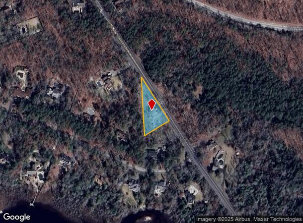
5045 Somers Point Rd
12-00981-03-00067
68
Retailwithmorethanonenonretailuse
Atlantic
X
New Jersey
34001C0287F
67
2024
1.24 AC
2025
Atlantic City/Hammonton
011404
Philadelphia
3,224 SF
Atlantic City-Hammonton, NJ
DEMOGRAPHICS near 5045 Somers Point Rd
1 Mile
3 Mile
5 Mile
2024 Total Population
879
11,438
32,924
2029 Population
860
11,196
32,221
Pop Growth 2024-2029
(2.16%)
(2.12%)
(2.14%)
Average Age
42
42
41
2024 Total Households
306
4,268
11,979
HH Growth 2024-2029
(2.94%)
(2.86%)
(2.76%)
Median Household Inc
$97,749
$73,405
$78,005
Avg Household Size
2.60
2.50
2.60
2024 Avg HH Vehicles
2.00
2.00
2.00
Median Home Value
$300,427
$226,985
$234,181
Median Year Built
1985
1984
1990
Nearby Places
Map Layers
Map Styles
 Street
 Aerial
- Restaurants
- Banks
- Shops
- Fitness
- Groceries
PUBLIC TRANSPORTATION
COMMUTER RAIL
Egg Harbor City (Atlantic City Line - NJ Transit Commuter Rail (NJ Transit))
DRIVE
WALK
Distance
Egg Harbor City (Atlantic City Line - NJ Transit Commuter Rail (NJ Transit))
15 min
8.9 mi
AIRPORT
Atlantic City International
DRIVE
WALK
Distance
Atlantic City International
37 min
13.6 mi
Freight Ports
Broadway Terminal - Pier 5
DRIVE
WALK
Distance
Broadway Terminal - Pier 5
61 min
45.7 mi
Nearby Properties
Address
Land Use
TOTAL SIZE
Lot Size
Zoning
Address
Land Use
TOTAL SIZE
Lot Size
Zoning
48.59 AC
IBP
Address
Land Use
TOTAL SIZE
Lot Size
Zoning
78.84 AC
GA-M
Address
Land Use
TOTAL SIZE
Lot Size
Zoning
19.70 AC
IBP
Address
Land Use
TOTAL SIZE
Lot Size
Zoning
53.17 AC
IBP
Address
Land Use
TOTAL SIZE
Lot Size
Zoning
312.70 AC
GA-M
Address
Land Use
TOTAL SIZE
Lot Size
Zoning
31.17 AC
GA-M
Address
Land Use
TOTAL SIZE
Lot Size
Zoning
28.50 AC
IBP
Address
Land Use
TOTAL SIZE
Lot Size
Zoning
622 SF
142.51 AC
PFMH
Address
Land Use
TOTAL SIZE
Lot Size
Zoning
75,248 SF
20.85 AC
IBP
Address
Land Use
TOTAL SIZE
Lot Size
Zoning
11,572 SF
19.68 AC
DC
Address
Land Use
TOTAL SIZE
Lot Size
Zoning
45.45 AC
IBP
Address
Land Use
TOTAL SIZE
Lot Size
Zoning
187.12 AC
RA
Address
Land Use
TOTAL SIZE
Lot Size
Zoning
71,556 SF
7.13 AC
R-9
Address
Land Use
TOTAL SIZE
Lot Size
Zoning
13,845 SF
18.28 AC
PVD
Address
Land Use
TOTAL SIZE
Lot Size
Zoning
22,723 SF
16.53 AC
IBP
Address
Land Use
TOTAL SIZE
Lot Size
Zoning
3,138 SF
12.26 AC
RD-5
Address
Land Use
TOTAL SIZE
Lot Size
Zoning
59,354 SF
5.29 AC
IBP
Address
Land Use
TOTAL SIZE
Lot Size
Zoning
32.32 AC
RA
Address
Land Use
TOTAL SIZE
Lot Size
Zoning
90,000 SF
5.64 AC
IBP
Address
Land Use
TOTAL SIZE
Lot Size
Zoning
19,543 SF
115.47 AC
GA-I
Address
Land Use
TOTAL SIZE
Lot Size
Zoning
59,362 SF
3.47 AC
R-9
Address
Land Use
TOTAL SIZE
Lot Size
Zoning
10,204 SF
4.82 AC
GA-L
Address
Land Use
TOTAL SIZE
Lot Size
Zoning
115.56 AC
RA
Address
Land Use
TOTAL SIZE
Lot Size
Zoning
5.36 AC
IBP
Address
Land Use
TOTAL SIZE
Lot Size
Zoning
1.14 AC
GC
Address
Land Use
TOTAL SIZE
Lot Size
Zoning
10.41 AC
DC
Address
Land Use
TOTAL SIZE
Lot Size
Zoning
Address
Land Use
TOTAL SIZE
Lot Size
Zoning
Address
Land Use
TOTAL SIZE
Lot Size
Zoning
Address
Land Use
TOTAL SIZE
Lot Size
Zoning
98.86 AC
IBP
The World's #1 Commercial Real Estate Marketplace
Connect with us
© 2025 CoStar Group
The information above has been obtained from sources believed reliable. While we do not doubt its accuracy we have not verified it and make no guarantee, warranty or representation about it. It is your responsibility to independently confirm its accuracy and completeness. Any projections, opinions, assumptions, or estimates used are for example only and do not represent the current or future performance of the property. The value of this transaction to you depends on tax and other factors which should be evaluated by your tax, financial, and legal advisors. You and your advisors should conduct a careful, independent investigation of the property to determine to your satisfaction the suitability of the property for your needs.